Click here to return to the Planning Hub
Pieterpad (Peter’s Path)
The King of the Dutch hiking trails
 The Pieterpad was conceived, walked and described between 1978 and 1983 by Toos Goorhuis-Tjalsma from Tilburg and Bertje Jens from Groningen. Two friends who thought that the Netherlands could use a seriously long distance path. They were inspired by a walking tour in the German Black Forest and wanted to create something similar in the Netherlands.
At your own pace, you’ll experience how enjoyable it is to walk through landscapes and regions that you might have only seen before from the car or train. The Pieterpad takes you over the smallest roads and paths, as much as possible unpaved. You determine the distance per day yourself, but away from all the daily worries you always have a wonderful walking experience.
Getting lost is impossible
With the step-by-step directions, the detailed maps, the marking in the field and the GPS tracks on this website, you simply can’t get lost. The route is published in two guides. Part 1 contains the northern part from Pieterburen to Vorden. Part 2 contains the southern part Vorden – Sint Pietersberg near Maastricht. The route is described and marked in two directions So you can choose to walk from north to south or vice versa.
Jabikspaad (St. Jacob’s Path)
A self-contained pilgrimage route
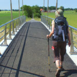 The origin of the Jabikspaad lies in the history of the first penitentiary who was sent on pilgrimage from Friesland. Abbot Freerk van Hallum sent around 1170 from the Norbertine Monastery Mariëngaarde heer Asing on a penitential pilgrimage. His companion Gertrudis reached Santiago de Compostela. She is the first Frisian pilgrim to “Sint Jacob” whom we know by name. The place where mariëngaarde monastery stood is located on the Jabikspaad (stage Oude Bildtzijl – Stiens).
The Jabikspaad is a self-contained pilgrimage route, but can be the first step for you on the way to a higher goal, the pilgrimage to Santiago de Compostela.
Walking or cycling along the Jabikspaad you can experience what a pilgrimage does to you. The rhythm of being on the road, encounters with nature (and with yourself), the culture and the landscape: experiences that you will never let go of.
There is a lot of background information available that is related to the Jabikspaad.
The Groate Church in Sint-Jacobiparochie houses a pilgrim information centre of the Dutch Society of Saint Jacob and the Jabikspaad Fryslân Foundation. The information centre was created by cooperation between the Âlde Fryske Tsjerken Foundation (which owns the Groate Church), with the Dutch Society of Saint Jacob, the province of Fryslân, the municipality of Het Bildt and the Jabikspaad Fryslân Foundation.
Watersnoodpad Trail
An investigation of flooding and water
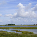 The Watersnoodpad is a 154 kilometer long walking route. The themed path runs along a large number of locations that have to do with the events during the Disaster of 1953 on Schouwen-Duiveland. One of the best things to do in the province of Zeeland is to walk the Watersnoodpad. The province of Zeeland was the most hard-hit province during the disaster in 1953. During this massive storm, which is still called the ‘Ramp’ in Dutch or the disaster, the dykes broke on the island of Schouwen-Duiveland and thousands of people and animals died. During this walking path in Zeeland, you will walk along many locations that are important to the ‘Ramp’ in The Netherlands.
Plus, you get to discover how the Delta Works in Zeeland are working and will understand better why they are built in the first place. This is one of the long-distance hiking paths in The Netherlands that starts and finishes at the same place: the city of Zierikzee.
On February 1, 1953, the dikes broke during a heavy northwesterly storm. The water flowed into the polders of Zeeland, but also of parts of South Holland and North Brabant. Thousands of people and animals drowned.
In 2013, Theo Klanke, who lives in Zeeland, developed a theme path about the Disaster: the Watersnoodpad. He chose to lay the path over Schouwen-Duiveland, because this is one of the hardest hit areas with many tangible memories. The 154 kilometer long route passes various locations that refer to the events of 1953. The path is divided into 10 stages with a length of 7 to 20 km. The Watersnoodpad is described in one direction in a hiking guide. The path is also signposted along the way.
The route runs from Zierikzee and Capelle to the Watersnoodmuseum in Ouwerkerk. At this place the dike broke on February 1, 1953, after which the seawater flooded a large part of the southwest of the Netherlands. Then the path goes via Nieuwerkerk and Oosterland to Bruinisse. Then you walk via Sirjansland, Dreischor, Noordgouwe, and Zonnemaire to Brouwershaven. The continuation of the Watersnoodpad goes via Scharendijke, Renesse, Burgh-Haamstede and Westenschouwen over the Oosterscheldekering to Neeltje Jans. The last part goes from Neeltje Jans via Burghsluis and Serooskerke back to Zierikzee.
Oosterscheldepad Trail
A dip into the Oosterscheldepad National Park
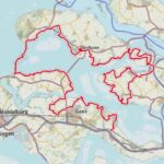 This is one of the regional hiking trails in The Netherlands and can also be found in the province of Zeeland that is located on the edge of the North Sea. This long-distance walking route in Zeeland shows you several Dutch islands, the National Park Oosterschelde and plenty of other beautiful destinations in Zeeland. One thing that you do need to know is that there are two parts of this route where you need to cross with a small ferry that is only in use during the summer months. The ferry needs to be taken at Anna Jacobapolder and from Gorishoek to Yerseke. The path starts at Yerseke and finishes in the town of Yerseke (which is famous for its mussels: eating them is one of the things to do in Yerseke). You need to follow the yellow-red signs as it’s a regional path.
The Oosterscheldepad is a varied regional path, which offers an introduction to the newest national park in the Netherlands. The centuries-long battle against the water is still clearly visible in many places along the route with old inlays, drowned polders and the most modern Delta Works.
Walking in Kruiningen you will come across a series of large and small mussel and oyster farms between the dike and the water of the Oosterschelde. You can smell the sea and can taste boiled mussels and the taste of the sea on every corner of the street, with thick fries or vegetables.
Trekvogelpad Trail
A must for ornithologists!
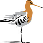 This hiking trail in The Netherlands was founded in 1999 when the bird protection organisation The Netherlands celebrated its 100th anniversary. The Trekvogelpad is made of three combined long-distance paths in The Netherlands: Waterlandpad, Heuvelrugpad and Gelrepad. You will start your journey in the town of Bergen aan Zee in the province of Noord- Holland and end in the village of Usselo near the city of Enschede. In this hiking trail, you will discover endless of birds species, a National Park, century-old paths and incredible towns. When you’re planning on walking this long-distance path in The Netherlands during the bird breeding season (15th of March- 1st of July), or when you want to walk this path with a dog, then you need to follow several alternative routes. This hiking route goes through National Park De Hoge Veluwe, which can only be accessed by buying an entry ticket.
The Trekvogelpad, also called ‘Pieterpad-overdwars’, is a must for ornithologists because the Trekvogelpad runs along many bird areas. The North Holland peat meadows, the Utrechts Heuvelrug, the sand drifts on the Veluwe and the Achterhoek. The Trekvogelpad shows you it all.


